Comprehensive Guide: How to Import GIS Data into InfraWorks
Geographic Information Systems (GIS) data plays a crucial role in infrastructure planning, design, and analysis. By importing GIS data into Autodesk InfraWorks, engineers, urban planners, and designers can incorporate real-world geographic information into their project models, enabling more accurate site analysis, visualization, and decision-making. In this comprehensive guide, we’ll explore the step-by-step process of importing GIS data into InfraWorks, from data acquisition and preparation to integration within the project model.
Table of Contents
- Introduction
- 1.1 Understanding GIS Data
- 1.2 Importance of GIS Data in Infrastructure Projects
- 1.3 Objectives of this Guide
- Types of GIS Data
- 2.1 Vector Data
- 2.2 Raster Data
- 2.3 Geospatial Databases
- 2.4 Web Map Services (WMS) and Web Feature Services (WFS)
- Acquiring GIS Data
- 3.1 Open Data Sources
- 3.2 Government Agencies and Organizations
- 3.3 Commercial GIS Data Providers
- Preparing GIS Data for Import
- 4.1 Data Conversion and Format Compatibility
- 4.2 Coordinate System and Projection
- 4.3 Data Cleanup and Quality Assurance
- Importing GIS Data into InfraWorks
- 5.1 Supported File Formats
- 5.2 Importing Vector Data
- 5.3 Importing Raster Data
- 5.4 Connecting to Geospatial Databases
- 5.5 Accessing Web Map Services (WMS) and Web Feature Services (WFS)
- Configuring GIS Data in InfraWorks
- 6.1 Layer Management and Organization
- 6.2 Styling and Symbolization
- 6.3 Attribute Mapping and Data Association
- Analyzing GIS Data in InfraWorks
- 7.1 Site Analysis and Contextual Mapping
- 7.2 Terrain Modeling and Visualization
- 7.3 Environmental Assessment and Impact Analysis
- Collaboration and Sharing
- 8.1 Sharing GIS Data with Team Members
- 8.2 Exporting InfraWorks Models with GIS Data
- 8.3 Publishing GIS Data Online for Public Access
- Best Practices and Tips
- 9.1 Data Management and Version Control
- 9.2 Data Integration and Interoperability
- 9.3 Continuous Data Updates and Maintenance
- Case Studies and Real-World Applications
- 10.1 Urban Planning and Development
- 10.2 Transportation Infrastructure Projects
- 10.3 Environmental Conservation and Management
- Future Trends and Innovations
- 11.1 Cloud-Based GIS Integration
- 11.2 Artificial Intelligence and Machine Learning
- 11.3 Real-Time Data Streaming and Analysis
1. Introduction
1.1 Understanding GIS Data
Geographic Information Systems (GIS) data consists of spatially referenced information about the Earth’s surface, including features such as roads, buildings, land parcels, vegetation, and environmental characteristics. GIS data is typically stored in digital formats and organized into layers or datasets, each representing a specific geographic feature or theme.
1.2 Importance of GIS Data in Infrastructure Projects
GIS data provides valuable context and spatial information for infrastructure projects, allowing designers and planners to analyze site conditions, assess environmental impacts, and optimize project designs. By integrating GIS data into InfraWorks, project stakeholders can make more informed decisions, streamline workflows, and improve collaboration throughout the project lifecycle.
1.3 Objectives of this Guide
This guide aims to provide a comprehensive overview of the process of importing GIS data into Autodesk InfraWorks. From acquiring and preparing GIS data to importing, configuring, and analyzing it within InfraWorks, this guide covers everything you need to know to effectively leverage GIS data in your infrastructure projects using InfraWorks.
2. Types of GIS Data
2.1 Vector Data
Vector data represents geographic features as points, lines, and polygons, defined by coordinates and attributes. Common types of vector data include roads, rivers, boundaries, and infrastructure assets. Vector data is often stored in file formats such as Shapefile (SHP), GeoJSON, or Keyhole Markup Language (KML).
2.2 Raster Data
Raster data consists of gridded images or matrices representing continuous surfaces, such as elevation models, aerial imagery, and land cover classifications. Raster data is commonly stored in formats like GeoTIFF, JPEG, or PNG, with each pixel containing a value representing a specific attribute or property.
2.3 Geospatial Databases
Geospatial databases store GIS data in structured formats, allowing for efficient storage, querying, and analysis of spatial information. Common geospatial database systems include PostgreSQL with PostGIS, Oracle Spatial, and Esri ArcSDE. Geospatial databases provide robust data management capabilities for large-scale GIS projects.
2.4 Web Map Services (WMS) and Web Feature Services (WFS)
Web Map Services (WMS) and Web Feature Services (WFS) enable the sharing and access of GIS data over the internet. WMS provides raster map images, while WFS allows for the retrieval and editing of vector features. These web services provide convenient access to real-time or authoritative GIS data sources for use in InfraWorks projects.
3. Acquiring GIS Data
3.1 Open Data Sources
Open data initiatives and government agencies often provide free access to GIS datasets for public use. Websites such as OpenStreetMap, USGS EarthExplorer, and Data.gov offer a wealth of GIS data covering various geographic themes and regions. Open data sources are valuable for obtaining foundational GIS data for infrastructure projects.
3.2 Government Agencies and Organizations
Government agencies at the local, regional, and national levels maintain GIS databases and provide access to spatial data for planning and development purposes. Departments of transportation, environmental agencies, and planning departments are examples of organizations that offer GIS data for infrastructure projects. Contacting these agencies can provide access to authoritative and up-to-date GIS data for your project.
3.3 Commercial GIS Data Providers
Commercial GIS data providers offer specialized datasets and services tailored to specific industries and applications. Companies such as DigitalGlobe, HERE Technologies, and Esri provide high-resolution imagery, geospatial datasets, and analytical tools for infrastructure planning and analysis. Commercial data providers offer a wide range of GIS data products, including aerial imagery, terrain models, and land use classifications.
4. Preparing GIS Data for Import
4.1 Data Conversion and Format Compatibility
Before importing GIS data into InfraWorks, ensure that it is in a compatible file format supported by the software. Convert data between formats using GIS software tools or data conversion utilities. Verify data integrity and compatibility to avoid issues during the import process.
4.2 Coordinate System and Projection
Ensure that GIS data is correctly georeferenced and aligned with the coordinate system and projection used in your InfraWorks project. Convert data between coordinate systems if necessary to maintain spatial accuracy and consistency between datasets. Coordinate system information should be clearly documented and communicated to all project stakeholders to ensure proper data integration and analysis.
4.3 Data Cleanup and Quality Assurance
Perform data cleanup and quality assurance procedures to ensure that GIS data is free from errors, inconsistencies, and inaccuracies. Check for missing or duplicate features, correct topology errors, and validate attribute data against known standards or specifications. Conduct thorough quality control checks to identify and resolve any issues before importing GIS data into InfraWorks.
5. Importing GIS Data into InfraWorks
5.1 Supported File Formats
InfraWorks supports a variety of file formats for importing GIS data, including Shapefile (SHP), GeoTIFF, KML/KMZ, and Esri File Geodatabase (GDB). Choose the appropriate file format based on the type of GIS data you’re importing and the compatibility with InfraWorks.
5.2 Importing Vector Data
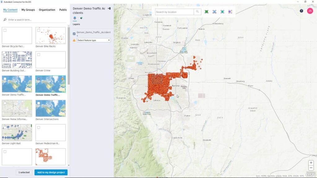
To import vector data into InfraWorks, navigate to the Data Sources panel and select the “Add” button. Choose the desired vector data file (e.g., Shapefile) from your local directory and follow the prompts to import the data into your project. InfraWorks will automatically recognize and display the imported vector features in the project model.
5.3 Importing Raster Data
Importing raster data follows a similar process to vector data. Select the “Add” button in the Data Sources panel and choose the raster data file (e.g., GeoTIFF) to import into your project. InfraWorks will import the raster imagery and display it as a background layer in the project model, allowing you to visualize and analyze the terrain or imagery data.
5.4 Connecting to Geospatial Databases
To connect to geospatial databases, such as PostgreSQL with PostGIS or Esri ArcSDE, navigate to the Data Sources panel and select the “Connect” button. Enter the connection parameters and credentials for the database server, then browse the available datasets and select the desired layers to add to your project. InfraWorks will establish a connection to the geospatial database and retrieve the selected data for display in the project model.
5.5 Accessing Web Map Services (WMS) and Web Feature Services (WFS)
To access web map services (WMS) and web feature services (WFS) in InfraWorks, navigate to the Data Sources panel and select the “Connect” button. Choose the option to add a web service and enter the URL or service endpoint for the desired WMS or WFS layer. InfraWorks will establish a connection to the web service and retrieve the selected data for display in the project model.
6. Configuring GIS Data in InfraWorks
6.1 Layer Management and Organization
After importing GIS data into InfraWorks, manage and organize the data layers to maintain clarity and organization within the project model. Use the Layers panel to toggle visibility, reorder layers, and adjust transparency settings to control the display of GIS data layers. Organize layers into logical groups and categories to facilitate data navigation and analysis.
6.2 Styling and Symbolization
Customize the styling and symbolization of GIS data layers to enhance visualization and interpretation within the project model. Use the Style Palette to apply predefined styles or create custom styles for vector features such as roads, buildings, and land use classifications. Adjust color, line thickness, and fill patterns to differentiate and highlight important features within the GIS data.
6.3 Attribute Mapping and Data Association
Associate attribute data from GIS datasets with InfraWorks objects to enable data-driven analysis and visualization. Use the Data Source Settings panel to map attribute fields to InfraWorks object properties, such as height, material, or classification. Establish data links and relationships between GIS data layers and InfraWorks objects to enrich the project model with additional information and context.
7. Analyzing GIS Data in InfraWorks
7.1 Site Analysis and Contextual Mapping
Utilize GIS data in InfraWorks to perform site analysis and contextual mapping of project areas. Analyze land use patterns, demographic data, and environmental factors to assess site suitability and identify constraints or opportunities for development. Use GIS data layers to create thematic maps and visualizations that provide insights into site conditions and characteristics.
7.2 Terrain Modeling and Visualization
Integrate GIS elevation data into InfraWorks to create detailed terrain models and visualizations. Use elevation data to generate surface models, contour lines, and slope analysis for terrain visualization and analysis. Incorporate raster imagery and elevation layers to enhance the realism and accuracy of terrain representations within the project model.
7.3 Environmental Assessment and Impact Analysis
Apply GIS data layers to conduct environmental assessment and impact analysis within InfraWorks. Evaluate habitat suitability, natural resource distribution, and ecological sensitivity using GIS data on environmental features and classifications. Perform spatial analysis to identify potential impacts of infrastructure projects on the surrounding environment and ecosystems.
8. Collaboration and Sharing
8.1 Sharing GIS Data with Team Members
Collaborate with project team members by sharing GIS data within InfraWorks. Use cloud-based collaboration features to share project models and data with stakeholders, consultants, and clients in real-time. Collaborate on design decisions, review analyses, and exchange feedback using shared project environments and data repositories.
8.2 Exporting InfraWorks Models with GIS Data
Export InfraWorks models containing GIS data for sharing or integration with other software applications. Use the export options to generate files in common formats such as Autodesk Civil 3D (DWG), Autodesk Revit (RVT), or FBX for interoperability with other Autodesk products. Export InfraWorks models with GIS data layers intact to maintain data continuity and fidelity across different platforms.
8.3 Publishing GIS Data Online for Public Access
Publish GIS data online for public access and engagement using web mapping platforms or interactive data portals. Share GIS data layers as web map services (WMS) or feature services (WFS) for viewing and exploration by stakeholders and the general public. Provide interactive maps, data visualizations, and analysis tools to promote transparency and community involvement in infrastructure planning and development.
9. Best Practices and Tips
9.1 Data Management and Version Control
Implement robust data management and version control procedures to ensure the integrity and reliability of GIS data within InfraWorks. Establish naming conventions, folder structures, and metadata standards for organizing and documenting GIS datasets. Maintain backups and archives of GIS data files to prevent data loss and facilitate data recovery in case of emergencies.
9.2 Data Integration and Interoperability
Maximize the interoperability and integration of GIS data with other software applications and systems used in the project workflow. Utilize industry-standard file formats and data exchange protocols to facilitate data sharing and collaboration between different platforms. Ensure compatibility between GIS data and InfraWorks by adhering to best practices for data conversion and format compatibility.
9.3 Continuous Data Updates and Maintenance
Regularly update and maintain GIS data to ensure that it remains accurate, current, and relevant throughout the project lifecycle. Incorporate new data sources, updates, and revisions into the project model to reflect changes in site conditions, regulations, or project requirements. Implement data validation