Comprehensive Guide: How to Create a New InfraWorks Project
Autodesk InfraWorks is a powerful software tool used by engineers, urban planners, and designers to create, analyze, and visualize infrastructure projects. Whether you’re designing roads, bridges, railways, or urban developments, InfraWorks provides the tools you need to bring your ideas to life. In this comprehensive guide, we’ll walk you through the step-by-step process of creating a new InfraWorks project, from initial setup to project configuration and customization.
Table of Contents
- Introduction
- 1.1 Overview of Autodesk InfraWorks
- 1.2 Importance of Creating a New Project
- 1.3 Objectives of this Guide
- Getting Started
- 2.1 Installation and Setup
- 2.2 Launching InfraWorks
- 2.3 Creating a New Project
- Project Configuration
- 3.1 Setting Project Location and Coordinate System
- 3.2 Choosing a Template
- 3.3 Configuring Design Settings
- Importing Data
- 4.1 Importing GIS Data
- 4.2 Importing CAD Files
- 4.3 Incorporating LiDAR and Point Cloud Data
- Designing Infrastructure
- 5.1 Creating Roads and Highways
- 5.2 Designing Bridges and Culverts
- 5.3 Adding Railways and Transportation Systems
- Modeling Terrain and Landscapes
- 6.1 Generating Terrain Models
- 6.2 Customizing Terrain Features
- 6.3 Adding Vegetation and Landscaping
- Analyzing and Simulating
- 7.1 Simulating Traffic and Vehicle Movements
- 7.2 Analyzing Drainage and Flood Risks
- 7.3 Conducting Solar Analysis
- Collaboration and Sharing
- 8.1 Collaborating with Team Members
- 8.2 Sharing Models and Presentations
- 8.3 Publishing Projects Online
- Best Practices and Tips
- 9.1 Organizing Project Data
- 9.2 Regular Backups and Version Control
- 9.3 Utilizing InfraWorks Resources and Support
- Case Studies and Real-World Examples
- 10.1 Infrastructure Projects
- 10.2 Urban Planning and Development
- 10.3 Environmental Analysis and Design
- Future Trends and Innovations
- 11.1 Integration with BIM and GIS Technologies
- 11.2 Advancements in Visualization and Rendering
- 11.3 Cloud-Based Collaboration and Workflows
1. Introduction
1.1 Overview of Autodesk InfraWorks
Autodesk InfraWorks is a 3D modeling and design software that enables engineers and designers to plan, design, and visualize infrastructure projects. From transportation networks to urban developments, InfraWorks provides a comprehensive suite of tools for creating and analyzing complex infrastructure projects in a dynamic and interactive environment.
1.2 Importance of Creating a New Project
Creating a new project in InfraWorks is the first step towards bringing your infrastructure ideas to fruition. A well-organized and properly configured project sets the foundation for efficient design, analysis, and collaboration throughout the project lifecycle. By creating a new project, you establish the framework within which you can explore design alternatives, evaluate impacts, and communicate your vision to stakeholders.
1.3 Objectives of this Guide
This guide aims to provide a detailed walkthrough of the process of creating a new InfraWorks project. From installation and setup to project configuration, data import, design, analysis, collaboration, and beyond, this guide covers everything you need to know to get started with InfraWorks and create impactful infrastructure projects.
2. Getting Started
2.1 Installation and Setup
Before you can create a new project in InfraWorks, you’ll need to install the software on your computer. Visit the Autodesk website to download and install InfraWorks, following the on-screen instructions. Once installed, launch the software and sign in with your Autodesk account credentials.
2.2 Launching InfraWorks
After launching InfraWorks, you’ll be greeted with the welcome screen, where you can choose to create a new project, open an existing project, or explore sample projects. Click on the “Create New Model” button to begin creating a new project.
2.3 Creating a New Project
Follow the prompts to set up your new project. Enter a name for your project, specify the location and coordinate system, and choose a template to use as a starting point. Click “Create” to generate your new project, and InfraWorks will open a new model with the specified settings.
3. Project Configuration
3.1 Setting Project Location and Coordinate System
When creating a new project, it’s essential to specify the project location and coordinate system to ensure accurate geospatial positioning and alignment with real-world data. InfraWorks allows you to select the project location using various methods, including entering coordinates, selecting from a map, or importing GIS data.
3.2 Choosing a Template
InfraWorks provides several templates to choose from, depending on the type of project you’re working on. Templates include pre-configured settings, styles, and components tailored to specific project types, such as roadway design, urban planning, or environmental analysis. Choose a template that best aligns with your project requirements to streamline the design process.
3.3 Configuring Design Settings
Once you’ve selected a template, you can further customize the project settings to meet your specific needs. This includes configuring design settings such as units of measurement, display settings, coordinate precision, and other project-specific parameters. Take the time to review and adjust these settings to ensure they align with your project requirements.
4. Importing Data
4.1 Importing GIS Data
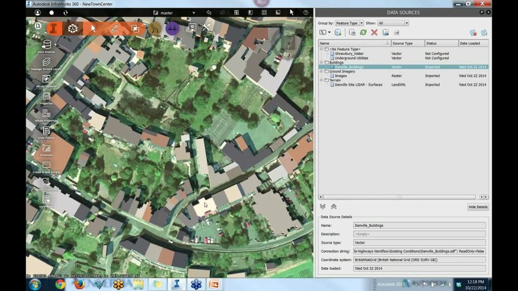
InfraWorks allows you to import GIS (Geographic Information System) data from various sources, including shapefiles, geodatabases, and web services. This data can include terrain elevation, land use, zoning, utilities, and other spatial information that forms the basis of your project. Import GIS data into InfraWorks to incorporate real-world context and geographic data into your project model.
4.2 Importing CAD Files
In addition to GIS data, you can also import CAD (Computer-Aided Design) files into InfraWorks, including DWG, DGN, and other CAD formats. This allows you to incorporate existing design data, such as road alignments, building footprints, and utility layouts, into your InfraWorks project model. Import CAD files to leverage existing design information and streamline the project workflow.
4.3 Incorporating LiDAR and Point Cloud Data
For projects requiring detailed terrain modeling or topographic analysis, InfraWorks supports the import of LiDAR (Light Detection and Ranging) and point cloud data. LiDAR data provides high-resolution elevation information, while point cloud data captures detailed 3D geometry of real-world objects and terrain. Incorporate LiDAR and point cloud data into your project to enhance the accuracy.
5. Designing Infrastructure
5.1 Creating Roads and Highways
InfraWorks offers powerful tools for designing roads and highways within your project. Utilize the road design tools to create alignments, profiles, cross-sections, and intersections. Customize road styles, lane configurations, and roadside features to accurately represent the proposed roadway design.
5.2 Designing Bridges and Culverts
Designing bridges and culverts is made easy with InfraWorks’ bridge design tools. Create bridge components, such as abutments, piers, and decks, and customize their parameters to match the design requirements. Incorporate culverts and drainage structures into your roadway design to ensure proper water management and infrastructure resilience.
5.3 Adding Railways and Transportation Systems
InfraWorks supports the design and visualization of railways and other transportation systems, such as light rail transit (LRT) and bus rapid transit (BRT). Use the rail design tools to create rail alignments, platforms, and station facilities. Visualize train movements and traffic flow to optimize the layout and operation of transportation networks.
6. Modeling Terrain and Landscapes
6.1 Generating Terrain Models
InfraWorks allows you to generate detailed terrain models based on imported elevation data or existing GIS information. Use the terrain modeling tools to modify landforms, create cut and fill regions, and sculpt the terrain to match the project requirements. Visualize elevation changes and terrain features in real-time to assess site conditions and design constraints.
6.2 Customizing Terrain Features
Customize terrain features such as rivers, lakes, and wetlands to accurately represent natural landscape elements within your project area. InfraWorks provides tools for creating water bodies, defining shorelines, and specifying water levels and flow patterns. Enhance the realism of your model by adding realistic water effects and environmental textures.
6.3 Adding Vegetation and Landscaping
Incorporate vegetation and landscaping elements into your InfraWorks project to create vibrant and realistic environments. Use the vegetation painting tools to populate the terrain with trees, shrubs, and other vegetation types. Adjust vegetation parameters such as species, density, and height to create natural-looking landscapes that enhance the visual appeal of your project.
7. Analyzing and Simulating
7.1 Simulating Traffic and Vehicle Movements
InfraWorks enables you to simulate traffic flow and vehicle movements within your project area. Use the traffic simulation tools to define vehicle routes, traffic signals, and intersection behaviors. Analyze traffic patterns, congestion levels, and vehicle conflicts to optimize roadway design and improve traffic safety and efficiency.
7.2 Analyzing Drainage and Flood Risks
Assess drainage and flood risks within your project area using InfraWorks’ hydrology and hydraulic analysis tools. Simulate rainfall events, runoff patterns, and flood inundation scenarios to identify areas prone to flooding and evaluate the effectiveness of drainage infrastructure. Design and optimize stormwater management systems to mitigate flood risks and protect infrastructure assets.
7.3 Conducting Solar Analysis
Evaluate solar exposure and shading effects on your project site using InfraWorks’ solar analysis tools. Calculate solar radiation, shadow patterns, and daylighting conditions to optimize building placement, orientation, and energy efficiency. Visualize solar data in real-time to inform site planning decisions and maximize solar potential for renewable energy generation.
8. Collaboration and Sharing
8.1 Collaborating with Team Members
InfraWorks facilitates collaboration among project team members through cloud-based sharing and collaboration features. Share project models, design data, and analysis results with stakeholders, consultants, and clients in real-time. Collaborate on design decisions, review project progress, and provide feedback using cloud-based collaboration tools.
8.2 Sharing Models and Presentations
Create compelling presentations and visualizations of your InfraWorks project to communicate your design intent and findings effectively. Use InfraWorks’ presentation tools to create interactive slideshows, flythrough animations, and virtual reality experiences. Share presentations with stakeholders and decision-makers to convey project concepts and solicit feedback.
8.3 Publishing Projects Online
Publish your InfraWorks project online to reach a wider audience and promote public engagement. InfraWorks allows you to publish project models to the Autodesk cloud platform or third-party hosting services. Share project models via web links or embed them directly into websites and online platforms for viewing and exploration by stakeholders and the general public.
9. Best Practices and Tips
9.1 Organizing Project Data
Maintain a structured and organized approach to managing project data within InfraWorks. Use folders, groups, and naming conventions to categorize and organize design elements, data sources, and analysis results. Adopt a consistent file naming scheme and folder structure to streamline data management and ensure accessibility for all project stakeholders.
9.2 Regular Backups and Version Control
Implement regular backups and version control procedures to safeguard project data and prevent data loss or corruption. Back up project files and data regularly to external storage devices or cloud-based backup services. Use version control software or built-in collaboration features to track changes, manage revisions, and maintain an audit trail of project updates and modifications.
9.3 Utilizing InfraWorks Resources and Support
Take advantage of the resources and support available through Autodesk and the InfraWorks user community. Access online tutorials, help documentation, and training materials to enhance your InfraWorks skills and knowledge. Participate in user forums, discussion groups, and webinars to connect with fellow users, share experiences, and troubleshoot issues collaboratively.
10. Case Studies and Real-World Examples
10.1 Infrastructure Projects
InfraWorks has been used in numerous infrastructure projects worldwide, ranging from transportation networks and utility systems to urban developments and environmental restoration projects. Case studies highlight the versatility and effectiveness of InfraWorks in addressing complex engineering challenges and delivering innovative solutions.
10.2 Urban Planning and Development
Urban planners and developers leverage InfraWorks to visualize and analyze urban growth, redevelopment, and revitalization projects. Case studies demonstrate how InfraWorks is used to create 3D urban models, assess land use scenarios, and engage stakeholders in the urban planning process.
10.3 Environmental Analysis and Design
Environmental engineers and consultants utilize InfraWorks to assess environmental impacts, evaluate site constraints, and design sustainable infrastructure solutions. Case studies showcase how InfraWorks is applied in environmental impact assessments, ecological restoration projects, and habitat conservation